Category Archives: Environment

Troubled Waters On The Delta

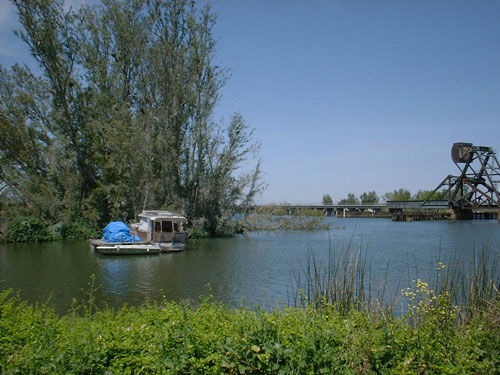
Picture courtesy of the California Department of Water Resources
Delta–Picture courtesy of the California Department of Water Resources

– By Bill Wells
The fabulous California Delta is within an hours drive of the Bay Area, yet you will feel you are in a different world.

The Delta is formed by the confluence of two major California rivers; the Sacramento and the San Joaquin, and covers some 500,000 acres in the central part of the state. It is home to 225 species of birds, 54 fish species, and 52 species of mammals. The Delta produces some $2 billion in annual crop revenue.

You can spend years exploring the 1,000 miles of local waterways by boat. If you travel by car, motorcycle, or bicycle, there are hundreds of miles of back roads, villages, and towns to visit.

You can ride on some of the only remaining ferry boats in California. Bird watching, wine tasting, local museums, antique shops, and art galleries are but a few of the points of interest you will encounter.

The Delta is also noted for it’s excellent fishing and duck hunting. The Rio Vista Bass Festival attracts 15,000 fishermen and friends each year It has been in existence.

Unfortunately, all is not well in this treasure we call “The Heart of California”. The State Water Project and the Central Valley Project divert much of the Delta water to Central and Southern California. The lower water flows in the Delta caused by the diversions have contributed to the decline in fish populations and proliferation of invasive plants that have clogged waterways over the last few decades.

Now with the administration’s plans to divert the Sacramento River around the Delta via twin 40 foot diameter tunnels, it is possible that what is left of the Delta will be destroyed.

Many local grass roots organizations have banded together to fight the project and the Environmental Protection Agency wrote a scathing letter to the National Marine Fisheries Service which has sent the California Natural Resource Agency back to the drawing board to modify the plan to make it less harmful to the estuary.

We are hopeful that the tunnels will never be built and that water flows will be restored to a level that will be beneficial to the native fish and plant life. With a finite water supply and an ever increasing population, California needs to look at ways of creating new water – not reallocating it from one area to another.


Bill Wells is the Executive Director of the California Delta Chambers & Visitor’s Bureau and has been active in the fight to preserve and protect the California Delta. He served for two plus years on the Bay Delta Conservation Plan (BDCP) public meeting panel and is currently a member of the Delta Protection Commission Advisory Committee.

Help keep this blog going
Call or write today for all your
real estate needs

John J. O’Dell Realtor® GRI
O’Dell Realty
(530) 263-1091
EMail John O’Dell
BRE#00669941

Error: Contact form not found.
More on the Water Wars in the Delta

1

Image 1 of 4

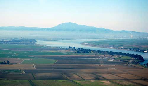
Mount Diablo And Sacramento River

Pictures 1, 2 and 3 courtesy of Bill Wells

The public comment period for the Bay Delta “Conservation” Plan to divert the Sacramento River around the Delta has ended but the California Water War continues for the foreseeable future.  The Natural Resource Agency and the Department of Water Resouces (DWR) continue to provide a lot of misinformation but they are continually met with citizen truth squads.  Here is a recent op-ed in the Tracy Press to correct  some bad information recently put out by DWR Director Mark Cowin.

Read more Tracy Press
 

Help to keep this website going
Call today for buying or selling real estate

John J. O’Dell Realtor® GRI
O’Dell Realty
(530) 263-1091
Email John

BRE#00669941

Cal-Fire Lifts Barn Ban in Nevada County November 1, 2013

httpv://youtu.be/4At3U_mVe7w

Residential Debris Burn Demonstration

However, burn permits are required.

Burning can only be done on a PERMISSIVE BURN DAY. You must call 530-274-7928 in Western Nevada County and 530-582-1027 in the Truckee area to see if it is a Permissive Burn day before you start burning

Escaped residential debris burns continue to be a leading cause of fire suppression calls in Nevada County. Learning to safely and cleanly burn vegetation debris helps to minimize smoke emissions and allows firefighters time to respond to true emergencies. It is your responsibility to know and follow local and state burning regulations. Failure to follow these regulations is a misdemeanor offense and you may be fined and prosecuted for the expense of containing a wildfire.

Visit the Fire Safe Council website to:

Burning is banned in the city limits of Grass Valley & Nevada City

Try the Fire Safe Council of Nevada County’s Chipping Program instead
Please help to keep this blog going
Let us Sell or help you buy your new home or land

John J. O’Dell Realtor® GRI
O’Dell Realty
(530) 263-1091
Email John

BRE#00669941

Enhanced by Zemanta

American Fire Update

american-fire-aug-26-2013

August 26, 2013

We continue to have smoke here in Nevada County. The American Fire is now 81% contained but it has burned over 24,400 acres.

Fire Status: The south, west and north perimeters of the fire remainin patrol status. This is due to completion of fire lines and minimalto no hot spots being detected inside the fire line in these areas.Crews have completed burning operations adjacent to the Mosquito Ridge Road, along the eastern perimeter. These burning operations haveconsisted of fire fighters lighting low intensity (“cool”) fire withthe intent of reducing ground fuels between the fire perimeter and themain fire. This tactic was highly successful as it reduced thepotential of the main fire escaping containment lines. Now thatburning operations are completed, these same crews will transitioninto detecting and extinguishing any remaining hot spots.With increased containment of the fire, additional fire crews havebegun work repairing areas affected by fire fighting activities. This has included chipping material piled next to roads during fire line construction as well as identifying needs to construct water controldevices along fire lines throughout the fire area.Forest visitors are asked to adhere to area and road closures. Theseclosures are in place to protect visitors and fire fighters. The roads and areas that have been closed are unsafe due to fire-weakened,burned trees that pose a risk of falling, as well as frequently heavy smoke making visibility extremely poor. These areas and roads will be re-opened as soon as possible.

Hand Crews: 28 Engines: 79 Dozers: 13 Water Tenders: 35 Helicopters: 4

Closure Update: Mosquito Ridge Rd (FSR 96) remains closed from thejunction of Ralston Ridge Rd (FSR 96-023) to the junction of theDuncan Diversion Dam access road (FSR 96-052), west of French Meadows Reservoir. Foresthill Rd remains closed from Humbug Canyon Road (FSR88-066) to Robinson Flat Campground and Forest Rd 43 (Robinson FlatRd) remains closed from Robinson Flat Campground to Mosquito Ridge Rd.Robinson Flat Campground and Duncan Peak Lookout also remain closed. French Meadow Reservoir and access to the Oxbow Middle Fork American Rafting Launch put in remain open.

A Community Meeting will be held tonight, Monday, August 26 at 7 p.m.at the Foresthill Veterans Memorial Hall, 24601 Harrison Street,Foresthill.Forest Order No 17-13-06 has closed portions of the Tahoe NF on theAmerican Ranger District.http://tinyurl.com/mvx4w3c

Further information: American Fire Information (530) 367-8020, 8 a.m.to 7 p.m. www.fs.usda.gov/tahoe Follow us on Twitter athttps://twitter.com/Tahoe_NF www.inciweb.nwcg.gov/incident/3624 Forsmoke information: www.placer.ca.gov/apcd


Please help to keep this blog going
Let us Sell or help you buy your new home or land

John J. O’Dell Realtor® GRI
O’Dell Realty
(530) 263-1091
Email John

DRE#00669941

Enhanced by Zemanta

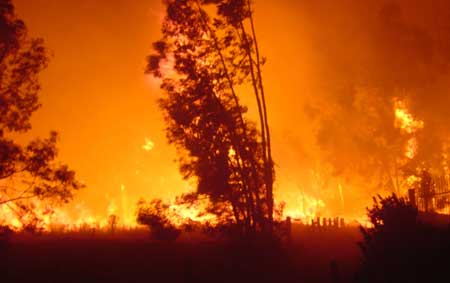
Be Fire Safe


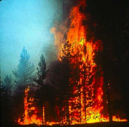
Forest fire.  Photo credit: Free-Extras.com
Forest fire. Photo credit: Free-Extras.com

Each year fire departments respond to thousands of fires started by people using equipment the wrong way. Whether working to create defensible space around your home, just mowing dry grass, or pulling your dirt bike over to the side of the road, if you live in a wild land area you need to use all equipment responsibly. Lawnmowers, weed eaters, chainsaws, grinders, welders, tractors and trimmers can all spark a wild land fire. Do your part, the right way to keep your community fire safe.

  • Mow before 10 a.m. If it’s too hot for you, it’s too hot to mow. REMEMBER, DON’T MOW DURING THE HEAT OF THE DAY OR WHEN THE WIND IS BLOWING!
  • Beware – Lawn mowers are designed to mow lawns, not dry grass, weeds or rocks! A grass-hidden rock is enough to start a fire when struck by a metal blade. Remove rocks from the area before you begin mowing.
  • In wild land areas, spark arresters are required on all portable gasoline powered equipment. This includes tractors, harvesters, chainsaws, weed eaters and mowers.
  • Keep the exhaust system, spark arresters and mower in proper working order and free of carbon buildup. Use the recommended grade of fuel and don’t top off.
  • In wild land areas, grinding and welding operations require a permit plus 10 feet of clearance, a 46-inch round point shovel, and a backpack water type fire extinguisher – all ready to use.
  • Hot exhaust pipes and mufflers can start fires you won’t even see-until it’s too late! Don’t drive your vehicle onto dry grass or brush.
  • Keep a cell phone nearby and call 911 immediately in case of a fire.

(C) 2005 Fire Safe Council

For more Fire wise tips visit the

Fire Safe Council of Nevada County’s website.


Please help to keep this website going
Email or call today:

John J. O’Dell Realtor® GRI
Civil Engineer
General Contractor
(530) 263-1091
Email

DRE# 00669941

Enhanced by Zemanta

American Fire Video

httpv://youtu.be/YhuL9QWkfX8

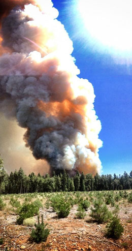
The American River Fire continues to burn. Heavy smoke continues in the recent areas that I traveled, Nevada City, Grass Valley, Auburn and Roseville. As of this morning, 14,822 acres have been consumed by fire.

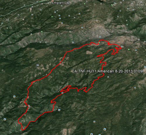
The fire is approximately 10 air miles northeast of Foresthill, CA, in steep, rugged terrain. While the fire is predominantly burning on the Tahoe National Forest within the North Fork of the Middle Fork American River drainage, there is a potential, given changes in weather or fire behavior, for the fire to threaten areas near Foresthill.

Active fire behavior continues on the eastern and southern flanks of the fire. Overnight, crews continued to build hand and dozer line to contain the active fire while evaluating future containment options. Firefighters will mop up and patrol containment line along Deadwood Road and Foresthill Divide Road south to the dozer line. Indirect line construction and mop up will continue down Deadwood Ridge. On the east side near Antoine, Manila and Screwauger Canyons, direct and indirect line construction will continue, with support of retardant drops.

Active fire behavior and roll out of burning material continue to be of concern, and will be closely monitored. Strong, erratic outflow winds and lightning may occur today, as the National Weather Service’s Red Flag Warning remains in effect until 11 p.m. Wednesday.

Active fire behavior in very steep, inaccessible terrain makes preparation of contingency lines critical. Indirect attack is the safest way to manage fire in areas of steep and difficult terrain.

American Fire perimeter August 20, 2013

Please help to keep this blog going
Let us Sell or help you buy your new home or land

John J. O’Dell Realtor® GRI
O’Dell Realty
(530) 263-1091
Email John

DRE#00669941

Enhanced by Zemanta

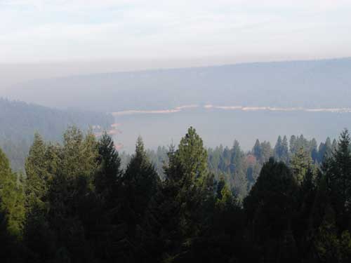
Today the Smoke Over Scotts Flat Lake is Worse


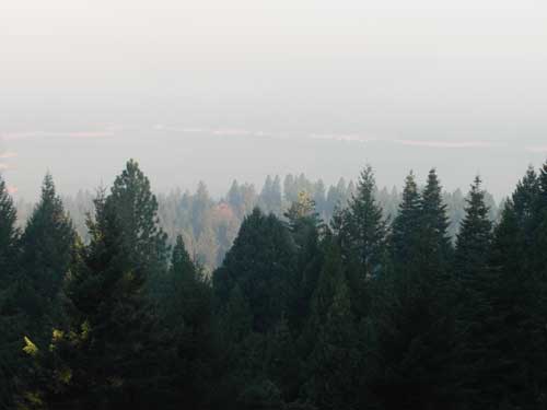
Smoke over Scotts Flat Lake August 13, 2013. Taken from my deck 830 am. Photo Credit John J. O'Dell
Smoke over Scotts Flat Lake August 13, 2013. Taken from my deck 830 am. Photo Credit John J. O’Dell

The smoke over Scotts Flat Lake was even worse this morning than yesterday.  I was smart enough to close my sliding glass doors and turn on the air conditioner during the night. Some of my friends living in Grass Valley  left their windows open and woke up to puffed eyes and sore throats.

The American fire is burning in heavy fuels on very steep slopes. The heavy fuels are creating large amounts of smoke The fire is located about 17 miles northeast of Foresthill in the Tahoe National Forest. Access to the fire is limited adding to the difficulty in fighting this fire. Firefighter safety is a concern.

Fire size is estimated at 1750 acres. The fire has burned across the North Fork Middle Fork American River and is burning both up and down the river drainage. The fire is being actively fought both directly and indirectly.

Multiple Forest Service and Cal Fire personnel are assigned to the fire. Currently 318 resources have been assigned including 18 crews, 16 engines, 4 helicopters, 5 dozers, 4 watertenders, and air tankers as available.

The Central Coast #7 Type II Incident Management Team has assumed managment of the fire.

Smoke is expected to impact Foresthill, Auburn, Nevada City, the valley and other areas for several days.

Please help to keep this blog going
Let us Sell or help you buy your new home or land

John J. O’Dell Realtor® GRI
O’Dell Realty
(530) 263-1091
Email John

DRE#00669941

Enhanced by Zemanta

Heavy Smoke Over Scott’s Flat Lake

Smoke over Scotts Flat Lake August 12, 2013. Picture taken by John O'Dell from my deck.
Smoke over Scott’s Flat Lake August 12, 2013. Picture taken by John O’Dell from my deck.

I woke up this morning and looked out my window to discover that Scotts Flat Lake was covered with smoke. Wondering where the fire was and hopefully not near my house, I looked at the Cal-Fire website to determine the location of the fire. Since the fire is in the Tahoe National Forest, I linked from Cal-Fire’s website  to  InciWeb for farther information

The fire started last Saturday around 4:10 pm.  Judy and I were at a wedding in Forest Hill at that time and we noticed smoke in and around Forest Hill.

The American fire is burning in a heavily forested area of very steep terrain on Deadwood Ridge, approximately 17 miles northeast of Forest Hill in Tahoe National Forest. Access to the fire is limited, and firefighter safety is a concern due to difficult terrain.

Fire size is estimated at 800-1,000 acres, with heavy smoke making it difficult to obtain precise numbers. The fire has crossed the North Fork of the Middle Fork of the American River and is burning toward the Last Chance area. Firefighters reported a moderate rate of spread with short uphill runs yesterday, and more of the same is expected today. Firefighters were able to make some progress on line construction overnight.

Multiple Forest Service and Cal Fire engines, crews, dozers, air tankers, and helicopters are committed, with additional resources on order. Smokejumpers are being utilized. Efforts are being focused mainly on the Deadwood Ridge and Last Chance sides of the fire. While firefighters are working to protect cultural resources from the fire and from suppression impacts, firefighter and public safety are the first priorities.

The Central Coast #7 Type II Incident Management Team is en route and expected to arrive today.

Smoke in the areas of Foresthill, Auburn, Nevada City, and the valley will likely continue over the next several days.

There are no current road closures, but people are being asked to stay out of the fire area for their own safety and the safety of firefighting personnel.

The town of Foresthill is not endangered and there are no evacuations ordered.

Fire Location


View Larger Map

Please help to keep this blog going
Let us Sell or help you buy your new home or land

John J. O’Dell Realtor® GRI
O’Dell Realty
(530) 263-1091
Email John

DRE#00669941

Enhanced by Zemanta

Burn Permits Suspended June 1st Tahoe National Forest Initiates Fire Restrictions

Photo Credit: maderafsc.org

Effective Saturday, June 1, 2013, residential burn permits will be suspended for Nevada, Placer, and Yuba Counties and fire restrictions will go into effect in the Tahoe National Forest announced both Brad Harris, CAL FIRE Nevada-Yuba-Placer Unit Chief and Tom Quinn, Tahoe National Forest Supervisor.  “Despite the recent, light rain, conditions in the foothills and the high country remain unseasonably dry for this time of year.  Warming temperatures, dry winds, and very dry fuel moisture levels have prompted this early fire season response,” stated Quinn.    “We have already seen fire activity that is not normally observed until late July or August.  The unusual lack of rain this past winter and spring, prompted the early burn ban and fire restrictions,” said Chief Harris.

Beginning June 1, the burn permit suspension applies to areas in Nevada, Yuba and Placer counties that fall within state responsibility area and local jurisdiction under contract with CAL FIRE.  Anyone who burns in violation of the suspension will be subject to appropriate civil or criminal action and could face cost recovery charges for the fire suppression response.  All fires or smoke reported will be considered a wildfire and a full suppression response will be dispatched to the scene.

In the Tahoe National Forest, beginning June 1, campfires are not permitted in the backcountry but only in developed campgrounds and other designated sites (in the metal rings/grills provided).  Portable stoves, including those that use gas, jellied petroleum or pressurized liquid fuel are permitted in backcountry areas with a valid campfire permit.  Propane-type Bar-B-Q’s can be used outside designated sites where camping is permitted, but charcoal Bar-B-Q’s can only be used in designated campgrounds.  Smoking is only permitted in an enclosed vehicle or developed recreation site.  Internal combustion engines, including off highway vehicles (OHV’s) can continue to be operated on roads or motorized trails and within the Prosser Pits OHV area.  The personal wood cutting program will continue to operate, as long as individuals have a valid woodcutting permit and follow the conditions on the permit. Campfire permits are free and are available at all Forest Service, BLM, or CAL FIRE offices.

Continue reading Burn Permits Suspended June 1st Tahoe National Forest Initiates Fire Restrictions

Water Wars In The Delta Continues

Photo credit: Bill Wells

By Burt Wilson
bwilson5404@sbcglobal.net

The Public Policy Institute of California (PPIC) event at the Sheraton last Friday was a signal to all the water agencies and their hangers-on that the PPIC wants to be a player in the California water war. If you will remember, the first PPIC report on the Delta a few years ago proposed an honest-to-goodness Peripheral Canal and a possible water barrier across the estuary at Chipps Island. Of course, we all know the Bechtal Corp., whose foundation funds PPIC, builds things like Peripheral Canals.

The event, in two words, was a “stacked deck.” Not one voice of opposition was seated on the stage. Only the usual cast of characters. The “environmental” voices were all party-liners, too. All did their thing and none bit the hand that pays them although Dr. Peter Goodwin, the head of the Delta Independent Science Board, speaking to the concept of Adaptive Management, did allow that, “There is so much uncertainty ahead of us that we have to have Adaptive Management.”
Almost every other word he used was “uncertainty.” I like this guy!

When he came off the stage, I met him with the statement, “Peter, if you want to stop uncertainty, just leave more water in the Delta and forget the tunnels.” He smiled and Jeff Kightlinger of the MWD, who was standing next to him, made a quick exit.

I got a chance to speak in a public comment period after the next group. I wanted to take issue with a couple of things Phil Isenberg, the Delta Stewardship Council chairman, said during his presentation. Phil began by philosophizing, saying, “The American People like to have a choice.” I told Phil, “That may be correct in the other 49 states, but not in California. We can’t vote on the twin tunnels of the BDCP plan. Jerry Brown is afraid he’ll lose. So we have no choice.”

I noticed that they did not give me the mic, but kept a firm grip on it while I spoke and took it away from me when I finished so I couldn’t reply to Phil’s answer. I did anyway. Shouted it out.
The other statement I took issue with was when Phil said, “Water problems make environmental problems.” I hit him with the same thing I told Dr. Goodwin privately, “Why not just leave the water in the Delta and don’t divert so much anymore and we can solve both our water and environmental problems.” Phil, as usual when he is cornered, retreated into a very long Shakespearian-like soliloquy that had all the characteristics of a fog moving under the bridge into SF Bay and swallowing up the city. It’s effect is that pretty soon people even forget the question. I think I even did.

The gamin-like Ellen Hanak, the PPIC chairperson for the event, was a strong facilitator and generally kept things moving but I didn’t hear one thing that I hadn’t heard before. The people sitting with me were curious about why she would give us a free continental breakfast and decent lunch to listen to 15 people telling us what we already know. You don’t spend that kind of money unless you want something back for it. What she got was the top water agency guys whose egos love the spotlight inherent in such functions.

Although the PPIC line differs here and there from the water agencies’ party line–but not so much as to make real waves–one came away with the impression that Hanak just wants to be a player with a seat at the water table. We’ll see.

A couple of more free lunches ought to do it, I thought.

On the other hand, doesn’t the Bechtal Corp. build water tunnels, too?


For all your real estate needs
Email or call today:

John J. O’Dell Realtor® GRI
Civil Engineer
General Contractor
(530) 263-1091
Email jodell@nevadacounty.com

DRE#00669941

Enhanced by Zemanta