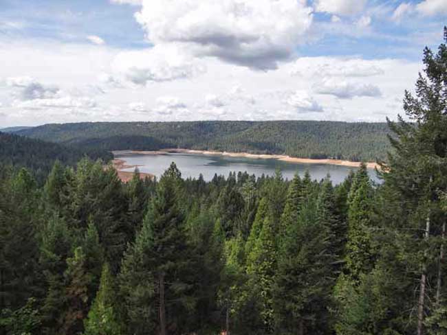
Pictures by John J. O’Dell from my deck.
The water level in the lake is down further than I’ve seen since I’ve lived in Cascade Shores, or at least it seems that way. Scotts Flat Lake or should I say reservoir, what’s the difference? A lake is a body of water but a reservoir is different because it’s level is deepest at the dam and some other technicalities . Oh, well, I still like to call it a lake. If you really want to know the difference between a lake and reservoir go to Lakes & Reservoirs.
If you want to see the projected water level for Scotts Flat Reservoir that was prepared by Nevada Irrigation District, go to picture 5. I’m guessing from my pictures and the graph for water levels for Scotts Flat Lake that the present elevation is around 3,036 foot elevation. The high appears to be 3,062 feet in elevation. That’s a 26 foot drop which cuts the water storage in half, from 40,000 acre feet to 25,000 acre feet. An acre foot is one foot of water over one acre of land or 43,560 cubic feet of water.
Scott’s Flat is situated among the tall pines at the 3100-foot elevation nine miles east of Nevada City via Highway 20 and Scott’s Flat Road. It offers 169 campsites at two large campgrounds, plus a group camp. Across the lake, accessible via Red Dog and Quaker Hill Roads from Nevada City, is the Cascade Shores Day Use Area. As you can see from my pictures, there a lot of trees around the reservoirs, oops lake.
Please help to keep this blog going
Let us Sell or help you buy your new home or land
John J. O’Dell Realtor® GRI
O’Dell Realty
(530) 263-1091
Email John
BRE#00669941


