Tag Archives: Cal Fire

Cal-Fire Lifts Barn Ban in Nevada County November 1, 2013

httpv://youtu.be/4At3U_mVe7w

Residential Debris Burn Demonstration

However, burn permits are required.

Burning can only be done on a PERMISSIVE BURN DAY. You must call 530-274-7928 in Western Nevada County and 530-582-1027 in the Truckee area to see if it is a Permissive Burn day before you start burning

Escaped residential debris burns continue to be a leading cause of fire suppression calls in Nevada County. Learning to safely and cleanly burn vegetation debris helps to minimize smoke emissions and allows firefighters time to respond to true emergencies. It is your responsibility to know and follow local and state burning regulations. Failure to follow these regulations is a misdemeanor offense and you may be fined and prosecuted for the expense of containing a wildfire.

Visit the Fire Safe Council website to:

Burning is banned in the city limits of Grass Valley & Nevada City

Try the Fire Safe Council of Nevada County’s Chipping Program instead
Please help to keep this blog going
Let us Sell or help you buy your new home or land

John J. O’Dell Realtor® GRI
O’Dell Realty
(530) 263-1091
Email John

BRE#00669941

Enhanced by Zemanta

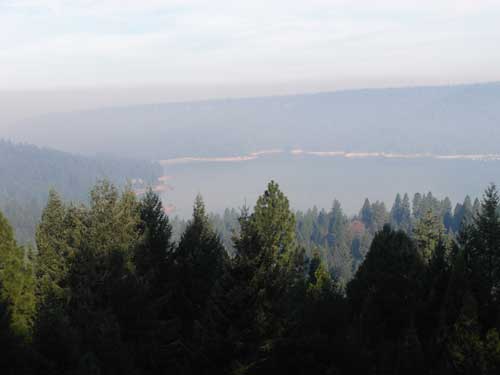
Heavy Smoke Over Scott’s Flat Lake

Smoke over Scotts Flat Lake August 12, 2013. Picture taken by John O'Dell from my deck.
Smoke over Scott’s Flat Lake August 12, 2013. Picture taken by John O’Dell from my deck.

I woke up this morning and looked out my window to discover that Scotts Flat Lake was covered with smoke. Wondering where the fire was and hopefully not near my house, I looked at the Cal-Fire website to determine the location of the fire. Since the fire is in the Tahoe National Forest, I linked from Cal-Fire’s website  to  InciWeb for farther information

The fire started last Saturday around 4:10 pm.  Judy and I were at a wedding in Forest Hill at that time and we noticed smoke in and around Forest Hill.

The American fire is burning in a heavily forested area of very steep terrain on Deadwood Ridge, approximately 17 miles northeast of Forest Hill in Tahoe National Forest. Access to the fire is limited, and firefighter safety is a concern due to difficult terrain.

Fire size is estimated at 800-1,000 acres, with heavy smoke making it difficult to obtain precise numbers. The fire has crossed the North Fork of the Middle Fork of the American River and is burning toward the Last Chance area. Firefighters reported a moderate rate of spread with short uphill runs yesterday, and more of the same is expected today. Firefighters were able to make some progress on line construction overnight.

Multiple Forest Service and Cal Fire engines, crews, dozers, air tankers, and helicopters are committed, with additional resources on order. Smokejumpers are being utilized. Efforts are being focused mainly on the Deadwood Ridge and Last Chance sides of the fire. While firefighters are working to protect cultural resources from the fire and from suppression impacts, firefighter and public safety are the first priorities.

The Central Coast #7 Type II Incident Management Team is en route and expected to arrive today.

Smoke in the areas of Foresthill, Auburn, Nevada City, and the valley will likely continue over the next several days.

There are no current road closures, but people are being asked to stay out of the fire area for their own safety and the safety of firefighting personnel.

The town of Foresthill is not endangered and there are no evacuations ordered.

Fire Location


View Larger Map

Please help to keep this blog going
Let us Sell or help you buy your new home or land

John J. O’Dell Realtor® GRI
O’Dell Realty
(530) 263-1091
Email John

DRE#00669941

Enhanced by Zemanta