Tag Archives: Hiking

Hiking The Yuba River Independence Trail Going East

By Judy J. Pinegar

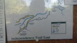
On Sunday, May  27, 2012 John and I went for a walk. Leaving the Flour Garden Cafe in Grass Valley, we traveled north on Hwy 49 to the parking lot for the Independence Trail. Studying the map, we decided to try the East Trail. We had Angel on a leash, and it seemed to be the direction she wanted to go, so we humored her.

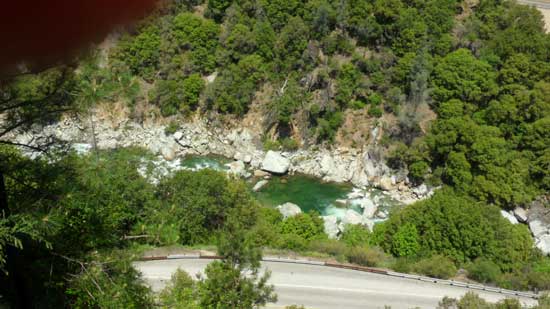
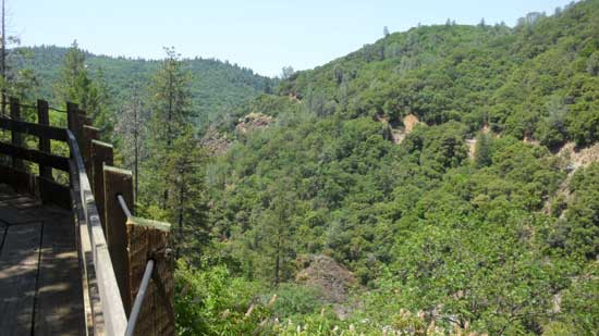
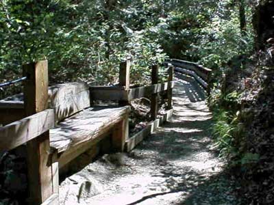
The first part of the trail seemed to literally be at two levels, the main trail on a lower level, a smaller trail on the rise to the left of the main  trail. Occasionally those traveling the higher trail were forced to move down to the lower trail, where the trail narrowed or over bridges, but the upper trail continued for quite some way. For a while the trail seemed to follow the highway, but finally we turned to follow the river, and there was a beautiful green swimming hole.
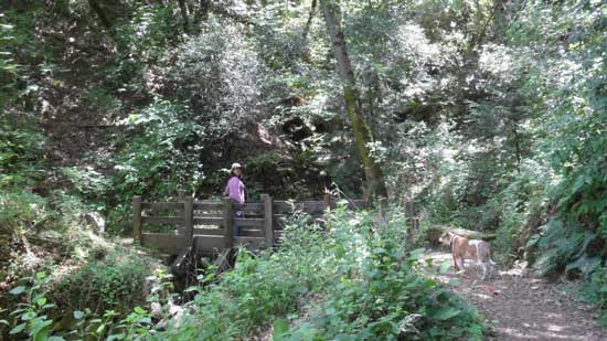
 

Creek Crossing
Creek Crossing

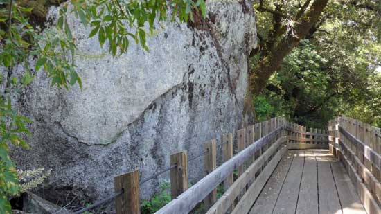
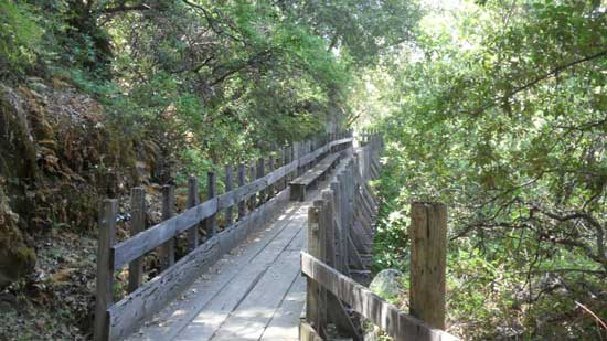
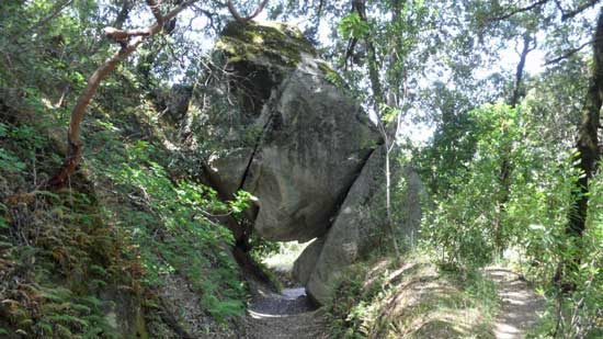
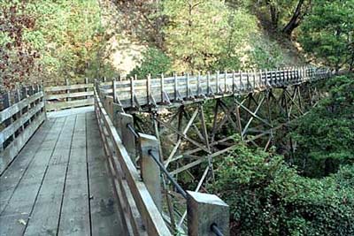
Continuing, the trail turned into a bridge the skirted the side of huge rocks, no ground beneath our feet! And then a neat tunnel, a rock perched on top of twp or three other rocks, and you could pass underneath if with just a little bit of tucking out heads; there was no way around it, so if you wanted to continue the walk, you went under the rock!!

Oh and did I mention the poison oak??  You could tell they had TRIED to eradicate the stuff on the main trails, but it was still there, hiding a little way back from the trail.  As a person who is horribly allergic, I stayed in the middle of the trail and hoped John would keep Angel out of it (she was getting no pats from me until she had a bath!).
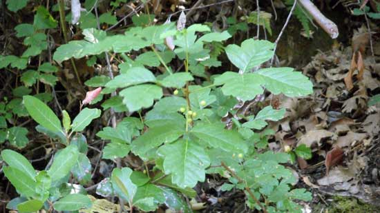
Posion Oak
Poison Oak

And speaking of Angel we had been forcing her to keep going on for about the last 15 minutes, for a strong, fierce looking dog, she really is a sissy in the wilds! After a good 45 minutes or so we met a couple coming back. They said they had walked for about an hour and hadn’t seen the river yet. We decided to follow Angels lead and come on back, next time maybe we will leave her home!

Judy J. Pinegar is a writer and her articles have appeared in many publications
John J. O’Dell Realtor® GRI
Civil Engineer
General Contractor
(530) 263-1091
Email jodell@nevadacounty.com
Enhanced by Zemanta

Empire Mine State Park, Grass Valley

httpv://www.youtube.com/watch?v=J_TjI2qLwBI

The Empire Mine is the site of the oldest, largest, and richest gold mine in California. From 1850 to its closing in 1956, it produced 5.8 million ounces of gold.This 5.8 million ounces of gold would fill a box 7 feet on each side. It is estimated that this represented only 20% of the available gold…80% remains. The Park contains many of the original mine buildings, the owners cottage and the restored gardens and grounds as well as the entrance to 367 miles (the equivalent of a round trip from Grass Valley to San Jose) of abandoned and flooded shafts and tunnels. The park consists of 845 acres of forested back country and 12 miles of trails for hikers, bikers and horseback riders.


View Larger Map

A Hike to Grouse Ridge, Land of a 100 Lakes

Jeff Toff, a local Grass Valley attorney  took a hike around Grouse Ridge with his dog Logan a few weeks ago. Logan is an Irish Wolfhound, and when Logan puts his front feet on Jeff, he’s a lot taller than Jeff. Jeff took many pictures while he was there and I’ve combined them into a video showing how beautiful Grouse Ridge really is.

A beautiful area, it has a geologic display of the 100 million year old birth of the Sierra Nevada Mountains. Just a few thousand years ago, the Rigde was further sculptured by volcanoes and glaciers, leaving over 100 lakes.

Today the story reveals the gentle and slow aging of the region: lakes reverting to meadows and gradual invasion of forests. Within its heart, scattered stands of mature trees offer stark contrast to polished and sculpted granite. Flowers are abundant and beautiful against the massive display of rock.

Grouse Ridge Campground is located approximately 24 miles east of Nevada City at an elevation of 5,600 feet. This campground has 9 walk-in campsites. There is no potable water but toilets are available. There is no trash removal service. Hiking, fishing and swimming are available from this campground.

Information on hiking trails can be found at the Tahoe National Forest website. There are four hiking trails listed. Scroll down towards the bottom of the page to find the information.


View Larger Map

Walk For Health, But Stay Healthy And Pain Free

by Lisa J. Lehr

Exercise is good. Some of us have undoubtedly made a New Year’s resolution to exercise more. And walking is, for most people, the best choice because it: 

1.      Doesn’t require much training; 

2.      Doesn’t require special equipment;  

3.      Doesn’t (usually) require travel to a special place, such as a gym, pool, or recreational area. 

Now, number 3 is somewhat qualified because, while most people in Nevada County live on or near a road with reasonably little traffic, walking on a paved road poses its own set of problems. If you get your regular exercise by walking along a public roadway, you may have noticed persistent or intermittent pain in the joints or muscles of your right leg.  

In most places, public roads are constructed with “crowning”; that is, the road is higher at the center and slopes down to the sides. This is to help rain and melting snow run off more quickly instead of pooling in the middle, creating a driving hazard and damage to the road. 

We learned as children to walk facing traffic, for obvious safety reasons: if an approaching car is too close to you, you can see it in time only if it’s approaching from the front—unless you have eyes in the back of your head (or wear a little tiny rear-view mirror, as cyclists sometimes do). The problem for walkers is that, as you walk along the edge of the road, one foot is always landing on a higher surface than the other. And over time, this can lead to pain in the hip, knee, and/or other parts of your leg. That, in turn, may discourage you from exercising; or you may just “live with” the pain, having no idea that it’s fixable.

I actually lived with this problem, off and on, for a couple decades before it dawned on me what might be causing it! 

Here are some suggestions to avoid one-sided leg pain: 

Continue reading Walk For Health, But Stay Healthy And Pain Free

Empire Mine State Park, Nevada County

Bourn Cottage
Bourn Cottage

I believe that one of the nuggets of Nevada County is the Empire Mine State Park. Located in Grass Valley, nestled among tall pines, oaks and cedars, it has been brought back to its original grandeur of the mining days of old.

This is really one of the state parks that is a must visit. To mention some of the activities there are 12 miles of beautiful trails for hiking, mountain bike riding and horse back riding. I have ridden my mountain bike on many of the trails and the trails range from flat to very, very steep. Visting the park is like going back in time to the 49’s era, seeing how the miners worked and how the rich mine owners lived.

Hardrock Trail - Photo by Jeff Herman

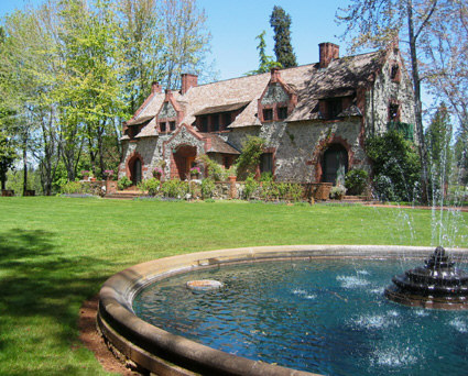
Tours are available inside the Bourn Cottage, as Volunteers in period dress recreate characters from Empire’s colorful past. This two story country home of William Bourn, Jr., styled after the noble estates of nineteenth century England, was built in the late 1890’s. The architecture is distinguished by a remarkable redwood interior, leaded glass windows and massive granite walls. Cottage Living History tours are available every weekend May through mid-October.

A brief history of the mine:

“For more than a century, from 1850 to 1956, the grumblings and rumblings of the stamp mill could be heard for miles around Grass Valley. Twenty-four hours a day, huge banks of machines sent iron rods crashing into chunks of ore blasted from deep inside the Earth. The noise was a constant. Living near the Empire Mine was like living near an interstate highway: You got used to it, or you went nuts.

“People only noticed when it stopped,” says Donna Jones, interpretive ranger at Empire Mine State Historic Park. “And one of the few times it stopped was when Maude Bourn married. They turned it off for three days.”

Maude Bourn was the daughter of William Bowers Bourn Jr., who took over the mine from his father in 1887 and went on to become a big name in California, leaving, among his many legacies, the 43-room Filoli mansion in Woodside and the Greystone Winery (now headquarters for the Culinary Institute of America) in St. Helena.

Empire Mine was one of the first — and eventually the largest and most productive — hard-rock mining operations in California, having its start with the discovery, in 1850, of flecks of gold in an outcropping of quartz where the park’s main parking lot is now. Some 5.8 million ounces were eventually extracted from the vein.

The usual method of entering the mine was aboard a cable-operated “man skip,” which resembled a giant toboggan on tracks. Twenty men at a time would pile on for the rip-roaring, 600-feet-per-minute ride into the bowels of the Earth.

“They always put the new men in front so that, if they lost their breakfast, it wouldn’t affect anyone else,” Jones says dryly.”

Source Sacramento Bee

For more information of the activities, fees and tour dates visit Empire State Park

If you have visited the park, please leave your comments of your impression of the park.


View Larger Map

Camp Far West Reservoir

 Picture courtesy of Camp Far West Lake Campgrounds
Picture courtesy of Camp Far West Lake Campgrounds

Camp Far West Phone Number (530) 633-0803

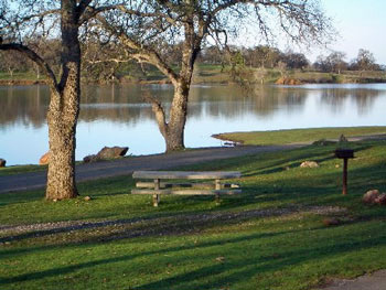
Camp Far West Reservoir also called Camp Far West Lake, is located at the junction of Placer, Nevada and Yuba counties. Both Beale Air Force Base and the Spenceville Wildlife Area lay directly to the north of the lake. The lake’s location makes it easily accessible by coming from Nevada City, Grass Valley and Western Nevada County along with Sacramento, Roseville or the Yuba City/Marysville area.

Camp Far West’s 185 foot high earth and rock dam was completed in 1963 as part of the Central Valley Water Project impounding water from both the Bear River and Rock Creek. The dam was built for the purpose of flood control and irrigation, but has proven to be a boon for anglers and recreational boaters in the years since.

Camp Far West is situated at an elevation of 280 feet. It is a fairly large lake, impounding 104,500 acre feet of water when at full capacity with a surface area of 2,000 acres and 29 miles of shoreline. The lake got its name from a gold rush era immigrant camp that was located just downstream from the present day dam site. Since it was the last camp on the immigrant trail before the 49ers coming from the east reached the Sacramento Valley, it was dubbed, Camp Far West.

In the spring when the lake is full, the hills are green and the oak trees lining the shoreline are covered with budding leaves, the lake is quite beautiful. In the fall when the water level is drawn down 60 feet or more, the grass is parched and the leaves have fallen, the visual impact isn’t quite as awe inspiring, but the camping and recreation can be just as good as it is early in the year, plus crowds are typically very light during the fall.

Fishes in the lake include largemouth and smallmouth bass, black bass, crappie, catfish, brown trout and striped bass.

Availability: The North Shore is open year-around. The South Shore is open mid-May to September.

Camping and Lodging: Camping facilities and a store are available at the lake. There are 70 campsites on the North Shore and 8 RV hookups. There are 67 campsites on the South Shore and no RV hookups.

Boat Launching: The North Shore and South Shore each has a boat launch ramp and mini marts. The mini marts also include tackle and bait.

Activities: Swimming, boating, water skiing, jet skiing, hiking, biking, fishing and horseback riding

Reservations and Fees: Camp Far West Lake (916) 408-5037 or (530) 633-0803

Their Website: Camp Far West Lake


View Larger Map

South Yuba River State Park, Nevada County, California

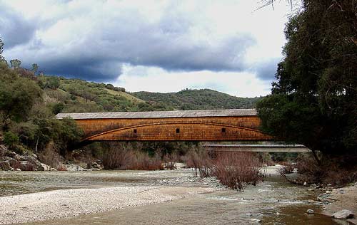
Bridgeport Covered Bridge, Nevada County, CA

The South Yuba River State Park, located in Nevada County,  is a 20-mile portion of the South Yuba River canyon stretching from Malakoff Diggings State Historic Park to Bridgeport covered bridge. The area includes the longest single-span covered bridge in the world, the steep rugged canyon of the South Yuba River, and the Independence Trail — the first identified wheelchair-accessible wilderness trail in the country.

Bridgeport is the centerpiece of the South Yuba River State Park which is one of only nine covered bridges built in the United States prior to 1900. Built in 1862 at 251 feet, it is still the longest single span covered bridge of its type in the United States. One theory as to why bridges were covered is that they were built of wood, and a covered wooden bridge would last longer. The Bridge is a State and National Historic Landmark.
There are many of things to do in the park:

swimming (Including shallow areas where children under family supervision can swim)
hiking
panning for gold
beautiful wildflowers in the spring
exploring the trails leading to historic mining sites
Docent-led history, nature, and gold-panning tours are also offered at selected times throughout the year.

The State of California Park division is offering gold panning lessons and you can log on to their web site at South Yuba River SP for their schedule.

Either Marya Miller or another birder offers a bird hike on the last Sunday of every month at 9:00 AM. Sitting astride the South Yuba River it is the seasonal home to a considerable variety of birds. The wide variety of avian life found throughout the year at Bridgeport is one of its prime attractions. While incomplete, a list would include several varieties of woodpeckers, swallows, owls, wild turkeys, black phoebes, hummingbirds, warblers, wrens, vireos and a wide variety of raptors, including golden and bald eagles.

Adventuresome hikers have a choice of trails ranging in difficulty from the easiest (Independence Trail), to other more strenuous trails throughout the park

South Yuba River State Park headquarters located at Bridgeport, 17660 Pleasant Valley Rd can be accessed from Highway 20 west of Grass Valley or from Higway 49 north of Nevada City. Remote portions of the park are accessible from Edwards Crossing, Purdon Crossing, and Highway 49.


View Larger Map

South Yuba River Independence Trail in Nevada County

independence-trail-bench-tr

One of the many nice trails located in Nevada County is the South Yuba River Independence Trail. I have walked this trail many times and it is truly a unique natural and historic jewel. The trail is fairly level, with wheelchair accessibility on both on the west and the east trail.

The main entrance to the Trail is on Highway 49, 5.5 miles from Nevada City, heading towards Downieville, near the South Yuba River bridge. Parking is available beside the road, with several marked disabled spaces. Highlighting the West Trail is a waterfall one mile from the entrance. People and wheelchairs travel a switchback ramp from Flume 28 (520 feet long) to the swirling waters of Rush Creek. Also featured on the west side is an overlook of the Yuba River, surrounded by canyon flora. The East Trail features cliff-hanging flumes, more views of the river and foothill landscapes, with a total of two and a half miles of maintained trail. There are picnic areas, outhouses, and scenic vistas all around. The Independence Trail is for all people, with its gradual, level walkway – from young mothers with stroller kids, to serious hikers and joggers, to seniors with limited mobility, to those in wheelchairs. Bathrooms are available along the way.

The origin of the Independence Trail was an old, abandoned miner’s ditch, previously known as the Excelsior Canal. It was built to carry water from the South Yuba river to hydraulic mining sites in Smartsville, 25 miles downstream. When California outlawed hydraulic mining in 1884, the ditch was used for irrigation until 1967, when it was abandoned. In 1975, a docent of the Oakland Museum, John Olmsted, re-discovered the whole water system consisting of the ditch, the berm, where the ditch-tender walked, and the wooden flumes which bridged the ravines. He had the vision to recognize that this could be the answer to a friend’s lifelong dream: “Please find me a level wilderness trail where I can reach out and touch the wildflowers from my wheel chair.”

Hiking distance: 2.5 miles downstream (west) or upstream (east) The west trail offers a 4.3 mile loop along a swimming trail to Jones Bar Road and then goes back to Excelsior Canal and back to the start.
To start Go 5.5 miles from Nevada City towards Downieville just short of the South Yuba River. There is parking along Hwy 49 including handicapped spaces.

Caution:
Winter and Spring weather conditions can cause the trail to become muddy and impassable for wheelchairs.

Call the South Yuba River State Park for trail condition information before you go.

More Information South Yuba Indendence Trail


View Larger Map

Nevada County Community Celebration of Trails to be Held June 6, 2009

Independence Trail off Hwy 49, Outside Nevada City, Towards Downieville

By: YubaNet.com
And Nevada County Land Trust

Grass Valley, CA May 15, 2009 – On Saturday, June 6 community members will enjoy the second annual Nevada County Celebration of Trails. Events will include a series of hosted trail rides, walks, and other activities throughout the day, between 10:00 am and noon. At 12:30 pm, everyone is invited to a community event held in the parking area of Twin Cities Church in Grass Valley to share trails information and hear exciting announcements of new trails to be dedicated.

Nevada County Land Trust, along with our western Nevada County community partners will sponsor this event to observe National Trails Day. Partners include a number of organizations interested in building, promoting, and maintaining local trail systems including: the City of Nevada City, Gold Country Trails Council, Bicyclists of Nevada County, Friends of Deer Creek, County of Nevada Planning Department, Rattlesnake Neighborhood Association and Sierra Outdoors with John Skinner and Greg Archbald.

National Trails Day is a celebration of trails that evolved from the report of President Ronald Reagan’s President’s Commission on Americans Outdoors. In 1987, the report recommended that all Americans be able to go out their front doors and within fifteen minutes, be on trails that wind through their cities or towns and bring them back without retracing steps. The recommendation, dubbed Trails for All Americans, became the impetus behind several public and private parties joining American Hiking Society in launching National Trails Day in 1993.

Trails activities: 10 am to noon

The public can choose events that suit their interests. Most events are free of charge.

– City of Nevada City and Sierra Club
What: A family friendly hike that will include natural, Maidu, mining, logging and modern history
Where: Hirschman’s Pond Trail – Trailhead located at 115 Cement Hill Rd.
When: 11:00am to 11:30am
Bring: Bug repellent and water. Sorry no strollers

– Nevada County Land Trust and Bicyclists of Nevada County
What: Kenny Ranch Trails, walk, run, mountain bike ride.
Where: Twin Cities Church parking area
When: 10 a.m. to Noon
Bring: Good walking shoes, water and/or your bike

– Friends of Deer Creek and American Rivers
What: National Trails Day Work Day. Volunteer to help work on a local trail.
Where: Champion Mine Rd at Old Downieville Hwy split – take Champion Mine Rd for a couple hundred yards and park in the pull-outs on the right – Trailhead is on the left.
When: 10 a.m. to 11:30 a.m.
Bring: Work clothes and water

– Gold Country Trails Council
What: Poker Ride at Skillman Horse Camp
Where: Tahoe National Forest
When: Sign up begins at 8:30 a.m. Ride out at 10 a.m.
For entry forms visit GCTC online at www.goldcountrytrailscouncil.org or contact Mary Johnson at 530.477.8501.

Celebration of Trails Event: 12:30 pm to 1:30 pm
Join us to celebrate and learn more about trails, hiking activities and outdoor recreation in our community.

– Trails Celebration hosted by Nevada County Land Trust
What: Trails celebration, award ceremony and gathering of outdoor organizations and enthusiasts.
Where: Twin Cities Church parking area, 11726 Rough and Ready Highway, Grass Valley
When: 12:30 to 1:30 p.m.

A full detail of events and activities can be found at Nevada County Land Trust-Trails Event