Tag Archives: Hiking

A Journey to Downieville, California

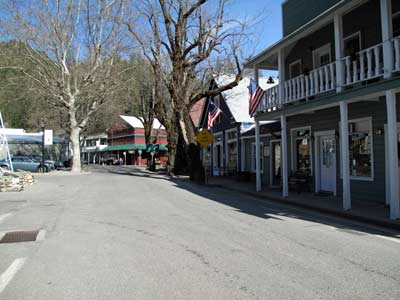
Downtown Downieville

 If you want a nice place to visit and a relatively short drive from Nevada City and Grass Valley then take a journey to Downieville. About forty five miles from Nevada City along scenic Highway 49, it’s a great drive, with a large portion of the trip along the North Fork of the Yuba River. Beautiful views of the river and forest, unsullied by human habitation! A group of us went up there last weekend to get away from it all. And we did!

We stayed at the Downieville River Inn a very nice Bed and Breakfast inn which is run by James & Diane Barnhard. Do not confuse this inn with the one right on Highway 49. I think this one is much quieter, definitely has more grounds and things to do (sauna, swimming pool, BBQ and lawn areas). Diane is a great cook if you come to the morning breakfast. You can even rent houses of various sizes for families who want to cook (or the whole place – there are 12 “units” but the place sleeps 40 people comfortably) for a group gathering or family vacation. Even many or the rooms have a small kitchenette, or refrigerator unit. 

After arriving at the inn, we took a one mile hike through town to the twin falls clear on the other side of the town. There are many other hiking trails, and the next day we took another mile hike along the river. Any time you are walking along and come across neighbors or people in the street, you can stop and talk to them. A visit to a restaurant is a time to start meeting the people next to you, where they are from, hobbies, and plans for the day. It is the friendliest town I have been to a long time.

Things to do while you are there includes, fishing, hiking, bicycle riding, there is museum and a couple of nice restaurants. There are numerous bike trails and many sponsored bike rides in the summer. Of course, there is also the natural beauty of the Sierras, with a confluence of the Downie River and the North Yuba River right in the heart of Downieville. When exploring the town, there is no need to drive your car, and the river is easily reachable to sit and just contemplate, or splash your feet.
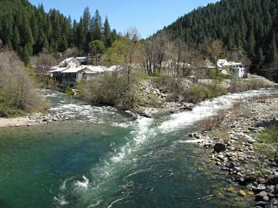
Convergence of Downie River on the left & Yuba River on the right.

 It’s a great little place to visit and it hasn’t changed much from the time I was County Engineer and County Surveyor for Sierra County. When I was up there in the 70’s the population of Sierra County was a little over 3,500 people and now, it’s still a little over 3,500 people! The town has a great gold mining history, stores sell the local gold and jewelry made from it. The town also has a unique history, when in July 1851,  lynched a woman, Junita, from the bridge across the North Yuba River for killing a miner.  It remains the only lynching of a female in California history.
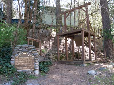
 

Sheriffs Gallows Downieville

There is also an original gallows, built in the town and used only, and still there for visitors to see. The gallows, called Sheriff’s Gallows, was constructed in 1885 for the specific execution of nineteen year old James O’Neill, a native of Ireland, who shot and killed his former employer, John Woodward, at Webber Lake, on the afternoon of August 7th.

The northern mines area was populated by a number of gold rush camps with colorful names, places like Brandy City, Whiskey Diggins, Poverty Hill, and Poker Flat. While many of these camps entirely disappeared after the gold rush, Downieville survived due both to its geographical location and status as the seat of Sierra County government

For information on camping, visit Downieville Ranger Station’s Campground Web Site. Also their telephone number is (530) 288-3231 

View Larger Map

Lake Spaulding & High Sierra Lakes

Lake Spaulding
Lake Spaulding

Nevada County has numerous lakes. Most of them are located in the high country between Nevada City and the City of Truckee. Some of these lakes are; Toll house Lake, French Lake, Lake Spaulding, Webber Lake, White Rock Lake and there are more! Many of the lakes were formed by ancient glaciers that are now long gone.

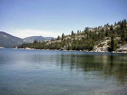
A few of the lakes provide hydroelectric power and is managed by Pacific Gas & Electric. Those owned by P.G.&E are used for hydroelectric power and the company provides camping grounds and picnic facilities. One of these is Lake Spaulding which sits at an elevation of 5,014 feet. It has a surface area of 698 acres surrounded by a high alpine forest. (Google Maps shows Lake Spaulding as Fordyce Creek)

The history of the lake is that it was built for hydraulic mining in 1912. Hydraulic mining generated millions of dollars in tax revenues but was an environmental disaster. Millions of tons of earth and water were delivered to mountain streams that fed rivers flowing into the Sacramento Valley. Once the rivers reached the relatively flat valley, the water slowed, the rivers widened, and the sediment was deposited in the floodplains and river beds causing them to rise, shift to new channels, and overflow their banks, causing major flooding, especially during the spring melt. The end came on January 7, 1884, Judge Lorenzo Sawyer ruled on the matter. – no more dumping of mining debris where it could reach farmlands or navigable rivers.

Lake Spaulding has 25 developed camp sites for tents and RV’s. Boating is allowed, including power, row boats, jet ski, windsurf, canoe, sail, water-ski and inflatable’s. However, check with P.G. & E. before you go up there, since rules and regulations change from time to time. This is also an area for fishing which include brown and rainbow trout. There is also swimming, picnicking, hiking and backpacking.

For reservations and further information, contact P.G.& E. Regional Land Department (916) 386-5164

Let me know if you can add to the above information, use the contact form and I’ll contact you.


View Larger Map

Lake Englebright in Nevada-Yuba County

lake-englebright2

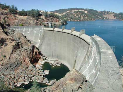
Englebright Lake offers a great deal of recreation including boating, camping and fishing. It’s located in Nevada-Yuba Counties, California. The lake was named after Harry Lane Englebright (January 2, 1884-May 13, 1943) who was a politician that served in the United States House of Representatives. He was a House minority whip between 1933 and 1943.  He was a mining engineer prior to entering politics in 1926 and was reelected every two years for the rest of his life.

Englebright Dam is a concrete arch structure and was constructed for the storage of hydraulic gold mining debris. The dam spans 1,142 feet across and is 260 feet high. The dam is in the steep Yuba River gorge known as the Narrows, holding back a 9 mile long lake with a surface area of 815 acres. It has 24 miles of shoreline and is at an elevation of 527 feet.

The shoreline is rocky and steep, with some areas of sandy beaches with pines and oaks.

lake-englebright1

Operating Hours:

Office hours are Monday – Friday 8:00 a.m. – 4:00 p.m. The park is open all year.

Camping:

Camping at Englebright Lake is unique as all campsites are boat-in only and located along the lake’s 24 miles of shoreline. Each campsite consists of a table, fire grill, lantern hanger and level spot for tents. Portable restrooms are centrally located in all campgrounds. Drinking water is available near each launch ramp.

Group Camping: (reservations required)

Point Defiance Recreation Area features a group campground that is available by reservation only. To help protect our natural resources, groups are limited to 50 people. Call the park office for reservations.

Boating:

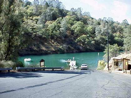
The lake provides plenty of space for the boating enthusiast, water skier or angler. Boats can be launched from one of two boat ramps located near the park’s entrance. Due to narrow canyons and sharp bends, the upper 4 miles of the lake are not suitable for waterskiing and/or towing any type of inflatable device. Therefore, these activities are restricted to the lower five miles of the lake. A counter-clockwise direction of travel is strictly enforced for the safety of park visitors. Types of boating allowed, power, row, Jet Ski, windsurf, canoe, sail, water ski, house, and inflatable’s are allowed. There is a full service marina with launch ramps. Rentals: fishing, canoe, water ski boats, houseboats & patio boats. There are also docks, berths, moorings and gas.

Fishing:

To the expert or beginning angler, Englebright means fish. Game fish such as rainbow and brown trout, large and smallmouth bass and Kokanee salmon abound in the lake’s clear, cool water. Catfish and sunfish can also be caught. Fish may be taken from the shore or boat by bottom fishing or trolling with bright, flashy lures.

Day Use:

Picnic facilities are available at the Narrows Recreation Area. Each site has a picnic table, barbeque grill and lawn area. Enjoy a short scenic hike to the dam overlook area or along the less strenuous fishing access trail.

Ranger Programs:Group tours and ranger programs can be scheduled by calling 530-432-6427.
Boat-in Camping: (first-come first-served basis)


Contacts:
U.S. Army Corps of Engineers
P.O. Box 6
Smartville, CA 95977-0006
(530) 432-6427 or fax (530) 432-6418
Email: englebright-info@usace.army.mil

Skippers Cove Marina  (530) 432-6302 offers boat  rentals, mooring, gas, sewage pumping and store facilities.

Additional information on the amount of settlement from the gold mining days and run off are available by a recent study made by the USGS at
Bathymetric and geophysical surveys of Englebright Lake

Rollins Lake in Nevada County

rollinslake1

There are many recreational lakes in Nevada County, one of which is Rollins Lake. The lake is located in an unincorporated area called Chicago Park, so called because the first settlers there were first generation Italian-Americans who settled in the area from Chicago.

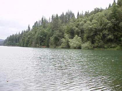
Rollins Lake is at an elevation of 2,100 feet, surrounded by a forest of pines, oaks and many other species of trees. It has a surface area of 900 acres with 26 miles of shoreline. You can sail or water ski on this lake which has many coves and long stretches of open water. Fishing is allowed, with many species of fish available which include brown trout, catfish, largemouth bass, crappie and bluegill. There is also swimming, picnicking, hiking and riding stables with horseback riding trails.

The boating which allowed on this lake include: power, row, Jet Ski, windsurf, canoe, sail, water ski and inflatable’s. You can also rent fishing boats with motors, canoes and paddle boats. There are four launch ramps, houseboat mooring and a floating gas dock.

rollinslake2

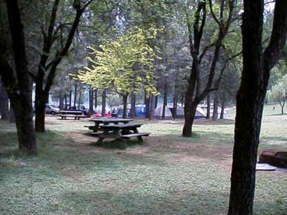
There are 250 developed camping sites for tents and RV’s. There are also full hookups for RV’s and trailer storage along with disposal station and flush toilets.

For further information contact:

Rollins Lake Resort Campground (530) 272-6100
Orchard Springs Campground      (530) 346-2212
Peninsula Campground                  (530) 477-9413
Long Ravine Campground             (530) 346-6166
View Larger Map

Malakoff Diggings State Park

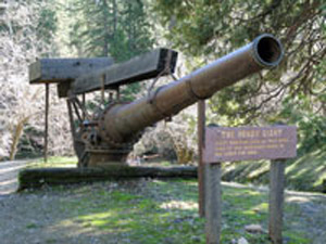
The Hendy Monitor, used to wash the mountains down

With all the bad news lately, it’s time to take a deep breath and think about all of the natural beauties that exist in this County. My friend Judy and I took a trip to Malakoff Diggings a couple of weeks ago. You can go the way we did, from Nevada City on Highway 49, turn right onto North Bloomfield Road, continue on until you come to the park. I prefer this route, with parts of the road steep with many switch backs, cutting across an old bridge over the South Yuba River. You can stop by the bridge and appreciate the wonders of nature and what the force of water can do to a river bed. Then continue on until you get to the park and the town of North Bloomfield.. Interesting, the web site of the State tells you that this route is not recommended. I guess if you are not used to driving in the mountains, it’s not a good way to go, but it is sure a beautiful drive. Google Map

The other way to go, which is a lot faster is to leave Nevada City, travel eleven miles up Highway 49 to left on Tyler Foote Road and continue on to the park. The road changes names several times, but stay on the pavement and you will get there to the park and North Bloomfield.  

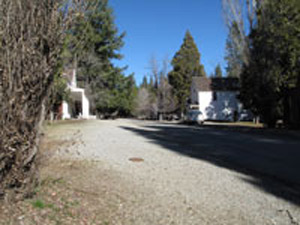
Downtown North Bloomfield

Once you get there, there are hiking trails, campgrounds and of course seeing the destruction that the miners seeking gold did to the surrounding mountains. It’s amazing that what was an ecological disaster at the time, has now become a state park. Time has pretty much healed the area with the forest coming back along with the animal life. In the center of the park is the historic town of North Bloomfield. The State has done a really good job of restoring many of the old buildings, and at certain times of the year they are open for you to go in and see what the old miners saw.

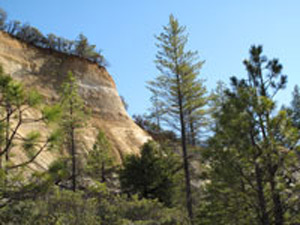
Mountain washed down by the miners seeking gold

In 1851 a miner came to town with a pocket full of gold. They followed him to what is now North Bloomfield and could find no gold, so they named the town Humbug. As the town grew to a population of 1,229 people, the residents wanted a post office, so they named the town Bloomfield. However there was another Bloomfield, so they named the town North Bloomfield. The present population is 2-12, I guess depending upon how many rangers are out there, and not counting the bears.

I could go on with the colorful history of the park, but detailed information is available at Wikipedia Malakoff State Historic Park and the website of the California State Parks Website

Take trip up there when the weather is nice, hike, relax, take a nice lunch with you and realize there is more to life then all the negative news we’ve been hearing lately.

Places to Enjoy Spring

Our county is green and wildflowers are springing up everywhere. Here are a few places you can go to enjoy the beauty.

  • The trails at Bridgeport, in the South Yuba River State Park. There are wildflower tours Saturdays and Sundays at 11am, but you can go there anytime.
  • Penn Valley’s Gateway Park. This is a great place to get together with friends and family with sports fields, playgrounds, picnic areas, an awesome disc golf course, and lovely little creek running through.

Driving Tours (from Grass Valley at the 49/20 intersection. Consider Dramamin or Bonine if you get carsick, these are winding roads.):

  • Take Highway 20 west to Pleasant Valley Road. Pleasant Valley Road north to Bridgeport. Get out, walk around, have a picnic, then get back in the car and continue north up the winding road to French Corral. Stop at French Corral to read the historic marker, then continue up Pleasant Valley Road to Hwy 49. Take 49 South through the canyon. Consider stopping at the South Yuba River for more hiking, or just a nice view of the river. Halfway up the south side of the canyon is the awesome Independence Trail, if you’re still up for a hike. Otherwise, continue back to Nevada City where you can get back on the Freeway.
  • Other options: Bitney Springs Road runs from just west of Grass Valley on the Rough & Ready Hwy to Pleasant Valley Rd. Whether you drive up from Pleasant Valley or down from Grass Valley this way, it shortens the loop described above, and is full of great scenery. Ready for a rough road? When you leave Bridgeport, there is a left turn onto a gravel road just a short distance up the hill—this leads to Rice’s Crossing. At the top of the hill, turn right and take the old Rice’s Crossing road up the hill. It comes out just below French Corral on Pleasant Valley Road. This is a great hike, too. Or take Mooney Flat Road west from Pleasant Valley Road (right after the Lake Wildwood Dam) down past Englebright Lake. Mooney Flat takes you right back to Hwy 20. This is a short loop.
  • Take McCourtney Road past the Fairgrounds and continue all the way down to Wolf Road. Take Wolf Road back to Hwy 49. Along the way you’ll see lots of beautiful scenery. Once you’re back at 49, you can return to Grass Valley, or continue across 49 and follow Combie Road to Magnolia Rd. Keep on Magnolia to Dog Bar. A left on Dog Bar will take you all the way back to Grass Valley. If you turn right, you can take Dog Bar to Placer Hills Road. A left on Placer Hills will take you up to Colfax, or a right will take you down towards Auburn, through Meadow Vista, to the Freeway at Clipper Gap.

Longer Drives:

  • Take Hwy 20 west to Marysville Road. Turn right and drive north. From here there a number of great routes:
    • Take Marysville Road past Collins Lake. There is a right turn to Dobbins and Oregon House that is still Marysville Road. If you miss the turn you will suddenly be on Willow Glen until that merges with LaPorte road, but that’s another story (below). Consider making an appointment to tour the Renaissance Winery before you head this way. It is out Rice Crossing Road east of Oregon House, and worth a visit for its great wine and beautiful gardens. (Yes, this is the same Rice Crossing Road we mentioned above, but NO you can’t get there from here. There’s private property, and a missing bridge across the Yuba.) Continue northeast on Marysville Road past Bullards Bar Reservoir (a great place for boating, camping, picnicing and mountain biking). Continue up Marysville Road to Hwy 49. Turn right (south) and return to Nevada City by way of North San Juan. (Also consider taking Moonshine Road just east of Bullards Bar. It will return you to Hwy 49 at the middle fork of the Yuba River. There’s a little picnic area and a covered bridge just across 49 from this intersection, too.)
    • After Browns Valley there is a left turn onto Loma Rica Road (Don’t take Fruitland Rd, which has a sign saying ‘Loma Rica’, wait until you see Loma Rica Road—actually, Fruitland Rd is pretty too, but I’m taking you through Bangor). Follow Loma Rica Road to Los Verjeles Rd and turn right. Follow Los Verjeles to Bangor and continue west on the Oroville-Bangor Hwy to Miners Ranch Road. Turn right on Miners Ranch and follow it to Hwy 162.

From here, there are two great options:

  • Turn right and go east to Forbestown Rd and follow that to old Forbestown. From Forbestown take the Challenge Cutoff to Brownsville (NOT Browns Valley). From Brownsville you can return via Willow Glenn Road to Marysville Road to Hwy 20 and return to Grass Valley.
  • Visit the famous Table Mountain wildflowers: turn left and drive toward Oroville on the Olive Hwy (162). Instead of turning when 162 does, continue on across the river on Washington Avenue. When you cross Montgomery, you’ll be on Table Mountain Blvd. Look for a right turn called Cherokee Rd. Follow Cherokee Rd. This will take you up over Table Mountain. From here you can either return, or continue via Derrick Rd. to historic Oregon City to see the little covered bridge and historic marker. There are two possible routes to follow from here: either return to Cherokee Rd, which will take you to Hwy 70 near Pence, if you turn right, or a left will take you back to Oroville the way you came. You can return to Grass Valley by taking 70 south (left) back to Marysville and pick up Hwy 20 there. You can also continue through Oregon City and loop back on Oregon Gulch Rd. to Cherokee and then return the way you came through Oroville or take 162 West to Hwy 70, and back by way of Marysville.

Take a map, some snacks, a camera, and an open mind. With the maps, trace your route and pick out alternatives to visit later. I’ve driven all these routes many times over the years, and I always find something new and wonderful by taking wrong turns (intentionally or not).

This post by Richard Webster