Tag Archives: lakes

Nevada Irrigation Districts Lakes and Canals have Unusal Titles

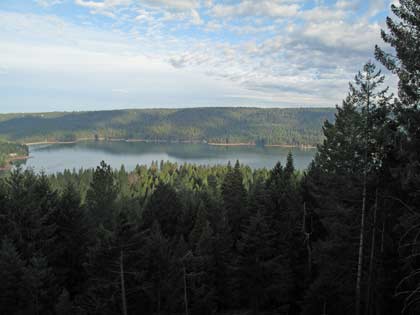
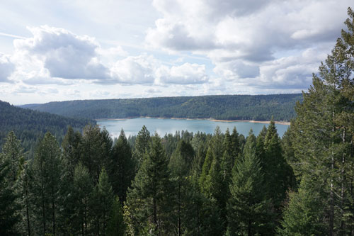
Scotts  Flat Reservoir. Picture taken from my deck. John J. O'Dell
Scotts Flat Reservoir. Picture taken from my deck. John J. O’Dell

How’s the water out there in Wiskey Diggins Canal? Was the Fiddler Green Canal titled after an early day musician? Did you ever wonder how the DSL Canal was named?

The names of water storage and distribution facilities throughout NID are colorful and unusual but, unfortunately, the origination of many of them has been lost through the years.

Many facilities are named for builders, such as Faucherie Reservoir, or for the geographic areas they serve, such as Bald Hill or Pet Hill canals.

Of course, many lakes and canals carry names that are rooted in the area’s rich mining history.

The DS Canal is the lowest elevation of the two NID canals crossed by Red Dog and Banner Lava Cap roads near Nevada City. It was built by NID in 1927-28 to carry water from Lower Scotts Flat into the Nevada City-Grass Valley area.  The DS Canal follows the south side of Deer Creek, hence DS for Deer Creek South. If NID had followed through with an initial plan for a canal on the north side, we would today have the DN Canal.

How Scott Flat was named is unclear, but it is widely understood that it was due to the Scottish miners who lived and worked there in the 1850’s and 1860’s.  Schools once stood near what is now the campground on the north side of the lake.

Rollins Reservoir was named for J.L. Rollins, manager of the Bear River Water and Power Co., the company from which NID acquired the land to build the reservoir.

NID’s first modern water treatment plan, the Elizabeth L. George plant on Banner Mountain, opened in 1969 and was named after the long time community leader who helped gain funding for its construction.

In the high country, Faucherie Reservoir, built prior to 1880, was named after a French engineer who worked for the Eureka Lake & Yuba Canal Co.  “The French must have had a strong influence because French Lake, located upstream of Faucherie and constructed in 1857-59 was originally called Eureka Lake and later changed to French Lake,” wrote NID retiree Terry Mayfield who documented much of the district’ history during his 34 years with the district.

One of NID’s most historic canals is reputed to be the first mining canal in the state.  The Rough & Ready Canal was begun in 1850 as the first effort to build a large-scale mining ditch in California.

According to the Thompson & West History of Nevada County, “a man named Moore commenced to dig one from Deer Creek above Nevada City to Rough and Ready. The magnitude of the undertaking astounded the miners and they thought Moore was a lunatic, but he persevered until he had completed one mile, and then abandoned the enterprise.”

Moore’s project was taken over by a company in 1851 and by 1854 the canal to Rough & Ready was complete. NID took over the canal in 1925 as part of a water system acquired from the old Excelsior Water & Power Co.  Portions of the 13-mile-long Rough and Ready & Ready Canal remain in use today.

Source: Nevada Irrigation District newsletter Volume 35 Number 4 Winter 2014/2015

Help keep this blog going
Call or write today for all your
real estate needs

John J. O’Dell Realtor® GRI
O’Dell Realty
(530) 263-1091

Error: Contact form not found.


BRE#00669941

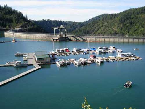
Bullards Bar Reservoir & Emerald Cove Marina, Dobbins, California

Emerald Cove Marina - photo courtesy of Emerald Cove Marina
Emerald Cove Marina – photo courtesy of Emerald Cove Marina

Bullards Bar Reservoir is not in Nevada County, but it is close enough to Nevada City and Grass Valley as to make it a destination for water skiing, house boating and fishing. It’s only 21 miles north of Nevada City off of Highway 49 in the historic gold country. The three closest cities are Nevada City, Grass Valley and Marysville.

The lake surface is at 2,000 foot elevation, 16 miles long with about 60 miles of shoreline. The boating surface is 4,700 acres, which is a lot of area to boat in. There are only two launch ramps and once you are in the water, you are surrounded by a greenbelt covered with pine, oak, fir, madrone, dogwood and other species of trees native to the area. As you cruise up into the North Yuba Canyon, sheer cliffs of granite come down to greet the crystal clear water.

The North Yuba River is backed up by New Bullards Bar Dam which is an awesome sight all by itself. Standing 645? above the canyon floor, it holds back 960,000 acre feet of water. It’s the second tallest dam in California, 5th tallest in the United States. A hydro-electric dam, Bullards Bar Dam is operated and controlled by the Yuba County Water Agency. They are able to manage the water so that recreation access to the reservoir is never restricted.

Bullards Bar offers boat access campgrounds, land based sites, and shoreline camping permits. There are a total of only 160 sites, which limits the amount of people the area can accommodate. Emerald Cove Marina takes site specific reservations for all camping.

For the fisherman, there are kokanee salmon, rainbow trout, German browns, large mouth, small mouth and black bass, crappie, catfish, and bluegill. Bullards Bar has a reputation as having the best kokanee salmon and black bass fishing in California.

CAMPING
Campgrounds – Call for reservations & fees
Pets, NO Hookups, Boat & Trailer Storage, Some Flush Toilets

BOATING
Power, Row, Jet ski, Windsurf, Canoe, Sail, Water-ski, and Inflatables are allowed.
There is a full service marina with gas and propane exchange available
Rentals: Houseboats, Ski Boats, Jet Skis, and Pontoon Patio Boats

RECREATION
Fishing
Swimming, Picnicking, & Hiking
Snacks, Groceries, Bait & Tackle and Fuel Dock

For further information and reservations contact   Emerald Cove Marina (530) 692-3200

View Larger Map
For all your real estate needs, call or email:

John J. O’Dell Realtor® GRI
Real Estate Broker
O’Dell Realty
(530) 263-1091
jodell@nevadacounty.com

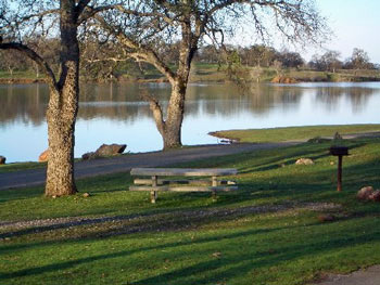
Camp Far West Reservoir

 Picture courtesy of Camp Far West Lake Campgrounds
Picture courtesy of Camp Far West Lake Campgrounds

Camp Far West Phone Number (530) 633-0803

Camp Far West Reservoir also called Camp Far West Lake, is located at the junction of Placer, Nevada and Yuba counties. Both Beale Air Force Base and the Spenceville Wildlife Area lay directly to the north of the lake. The lake’s location makes it easily accessible by coming from Nevada City, Grass Valley and Western Nevada County along with Sacramento, Roseville or the Yuba City/Marysville area.

Camp Far West’s 185 foot high earth and rock dam was completed in 1963 as part of the Central Valley Water Project impounding water from both the Bear River and Rock Creek. The dam was built for the purpose of flood control and irrigation, but has proven to be a boon for anglers and recreational boaters in the years since.

Camp Far West is situated at an elevation of 280 feet. It is a fairly large lake, impounding 104,500 acre feet of water when at full capacity with a surface area of 2,000 acres and 29 miles of shoreline. The lake got its name from a gold rush era immigrant camp that was located just downstream from the present day dam site. Since it was the last camp on the immigrant trail before the 49ers coming from the east reached the Sacramento Valley, it was dubbed, Camp Far West.

In the spring when the lake is full, the hills are green and the oak trees lining the shoreline are covered with budding leaves, the lake is quite beautiful. In the fall when the water level is drawn down 60 feet or more, the grass is parched and the leaves have fallen, the visual impact isn’t quite as awe inspiring, but the camping and recreation can be just as good as it is early in the year, plus crowds are typically very light during the fall.

Fishes in the lake include largemouth and smallmouth bass, black bass, crappie, catfish, brown trout and striped bass.

Availability: The North Shore is open year-around. The South Shore is open mid-May to September.

Camping and Lodging: Camping facilities and a store are available at the lake. There are 70 campsites on the North Shore and 8 RV hookups. There are 67 campsites on the South Shore and no RV hookups.

Boat Launching: The North Shore and South Shore each has a boat launch ramp and mini marts. The mini marts also include tackle and bait.

Activities: Swimming, boating, water skiing, jet skiing, hiking, biking, fishing and horseback riding

Reservations and Fees: Camp Far West Lake (916) 408-5037 or (530) 633-0803

Their Website: Camp Far West Lake


View Larger Map

Bullards Bar Lake, Dobbins, California

Emerald Cove Marina - photo courtesy of Emerald Cove Marina

While Bullards Bar Lake is not in Nevada County, it is close enough to Nevada City and Grass Valley as to make it a designation for water skiing, house boating and fishing. It’s only 21 miles north of Nevada City off of Highway 49 in the historic gold country. The two closest cities are Nevada City, Grass Valley and Marysville.

The lake surface is at 2,000 foot elevation, 16 miles loan with about 60 miles of shoreline. The boating surface is 4,700 acres, which is a lot of area to boat in. There are only two launch ramps and once you are in the water, you are surrounded by a greenbelt covered with pine, oak, fir, madrone, dogwood and other species of trees native to the area. As you cruise up into the North Yuba Canyon, sheer cliffs of granite come down to greet the crystal clear water.

The North Yuba River is backed up by Bullards Bar Dam which is an awesome sight all by itself. Standing 645′ above the canyon floor, it holds back 960,000 acre feet of water. It’s the second tallest dam in California, 5th tallest in the United States. A hydro-electric dam, Bollards’ Bar Dam is operated and controlled by the Yuba County Water Agency. They are able to manage the water so that recreation access to the reservoir is never restricted.

Bullards Bar offers boat access campgrounds, land based sites, and shoreline camping permits. There are a total of only 160 sites, which limits the amount of people the area can accommodate. Emerald Cove takes site specific reservations for all camping.

For the fisherman, there are kokanee salmon, rainbow trout, german browns, largemouth, smallmouth and black bass, crappie, catfish, and bluegill. Bullards Bar has a reputation as having the best kokanee salmon fishing in California.

CAMPING
39 Boat access campgrounds – Call for reservations & fees
Pets, Full Hookups, RV & Trailer Storage, Disposal Station, Flush Toilets

BOATING
Power, Row, Jet ski, Windsurf, Canoe, Sail, Water-ski, and Inflatables are allowed.
There is a full service marina with gas and propane available
Rentals: Fishing Boats with Motors, House Boats

RECREATION
Fishing
Swimming, Picnicking, & Hiking
Snack Bar, Groceries, Bait & Tackle

For further information and reservations contact   Emerald Cove Resort and Marina (530) 692-3200


View Larger Map


Enhanced by Zemanta

Scotts Flat Lake, Nevada City, CA

Scotts Flat Lake picture from my deck March 21, 2009

My house overlooks Scotts Flat Lake and as you can see in the picture above, I get a really beautiful view of the lake . It’s a wonderful experience living above such a body of water, which is constantly changing appearance, either due to wind or other forces of nature. At times I can look out and see fog completely covering the lake, at other times; wind plays with the water and makes designs that are captivating to the eye and imagination. The lake is large enough for fairly large sail boats (my daughter had a 25 foot long sail boat that she sailed on the lake and there are  larger sail boats that use the lake), along with ski boats, canoes and small boats for fishing.

Scotts Flat Lake is at 3,100 feet in elevation and has a surface area of 850 acres with 7.5 miles of shoreline lined with a forest of pine trees. There are two launch ramps, a marina, campsites, a picnic area, sandy beaches and a general store. (My house is at 3,700 foot elevation.)

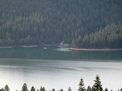
Looking at far side of Scotts Flat Lake, boat ramp and camp ground area. Notice the wind patterns

The fish in the lake are German Brown Trout, Massachusetts Brown Trout, Rainbow Trout, Kokanee, Large Mouth Bass, Small Mouth Bass, Bullhead Catfish and Channel Catfish. There are sites that are available for camping at Gate 1 with nightly single sites, and (1) one hundred person group site, Gate 2 has seventy five single sites and three group sites, one hosts twenty, one hosts thirty and  the third one hosts forty people.

Showers and flush toilets are available, along with multiple RV sites, but no RV hookupsare available. However, they do have dumping facilities for RV’s. You can bring pets, however they must be leashed at all times and they are not allowed along the beach or swim areas.

Below Scotts Flat Lake is Lower Scotts Flat, also called Deer Creek Reservoir which is much smaller than the upper lake. The only water craft I’ve seen here are mainly canoes and a few small boats for fishing.

For more information and to make reservations for camping follow this link Scotts Flat Lake Reservations

For a map of the lake follow this link Map of Scotts Flat Lake