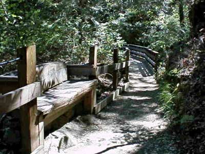
One of the many nice trails located in Nevada County is the South Yuba River Independence Trail. I have walked this trail many times and it is truly a unique natural and historic jewel. The trail is fairly level, with wheelchair accessibility on both on the west and the east trail.
The main entrance to the Trail is on Highway 49, 5.5 miles from Nevada City, heading towards Downieville, near the South Yuba River bridge. Parking is available beside the road, with several marked disabled spaces. Highlighting the West Trail is a waterfall one mile from the entrance. People and wheelchairs travel a switchback ramp from Flume 28 (520 feet long) to the swirling waters of Rush Creek. Also featured on the west side is an overlook of the Yuba River, surrounded by canyon flora. The East Trail features cliff-hanging flumes, more views of the river and foothill landscapes, with a total of two and a half miles of maintained trail. There are picnic areas, outhouses, and scenic vistas all around. The Independence Trail is for all people, with its gradual, level walkway – from young mothers with stroller kids, to serious hikers and joggers, to seniors with limited mobility, to those in wheelchairs. Bathrooms are available along the way.
The origin of the Independence Trail was an old, abandoned miner’s ditch, previously known as the Excelsior Canal. It was built to carry water from the South Yuba river to hydraulic mining sites in Smartsville, 25 miles downstream. When California outlawed hydraulic mining in 1884, the ditch was used for irrigation until 1967, when it was abandoned. In 1975, a docent of the Oakland Museum, John Olmsted, re-discovered the whole water system consisting of the ditch, the berm, where the ditch-tender walked, and the wooden flumes which bridged the ravines. He had the vision to recognize that this could be the answer to a friend’s lifelong dream: “Please find me a level wilderness trail where I can reach out and touch the wildflowers from my wheel chair.”
Hiking distance: 2.5 miles downstream (west) or upstream (east) The west trail offers a 4.3 mile loop along a swimming trail to Jones Bar Road and then goes back to Excelsior Canal and back to the start.
To start Go 5.5 miles from Nevada City towards Downieville just short of the South Yuba River. There is parking along Hwy 49 including handicapped spaces.
Caution:
Winter and Spring weather conditions can cause the trail to become muddy and impassable for wheelchairs.
Call the South Yuba River State Park for trail condition information before you go.
More Information South Yuba Indendence Trail